
UnGovr Atlas
LIVEEach layer of government, mapped to the ground it serves.
Most directories list agencies. The Atlas maps them: each entity is tied to the territory it governs, so a single point on Earth resolves to the full stack of governments serving it. That difference is what makes everything else UnGovr builds possible.
One record, two views
In the schema. On the site.
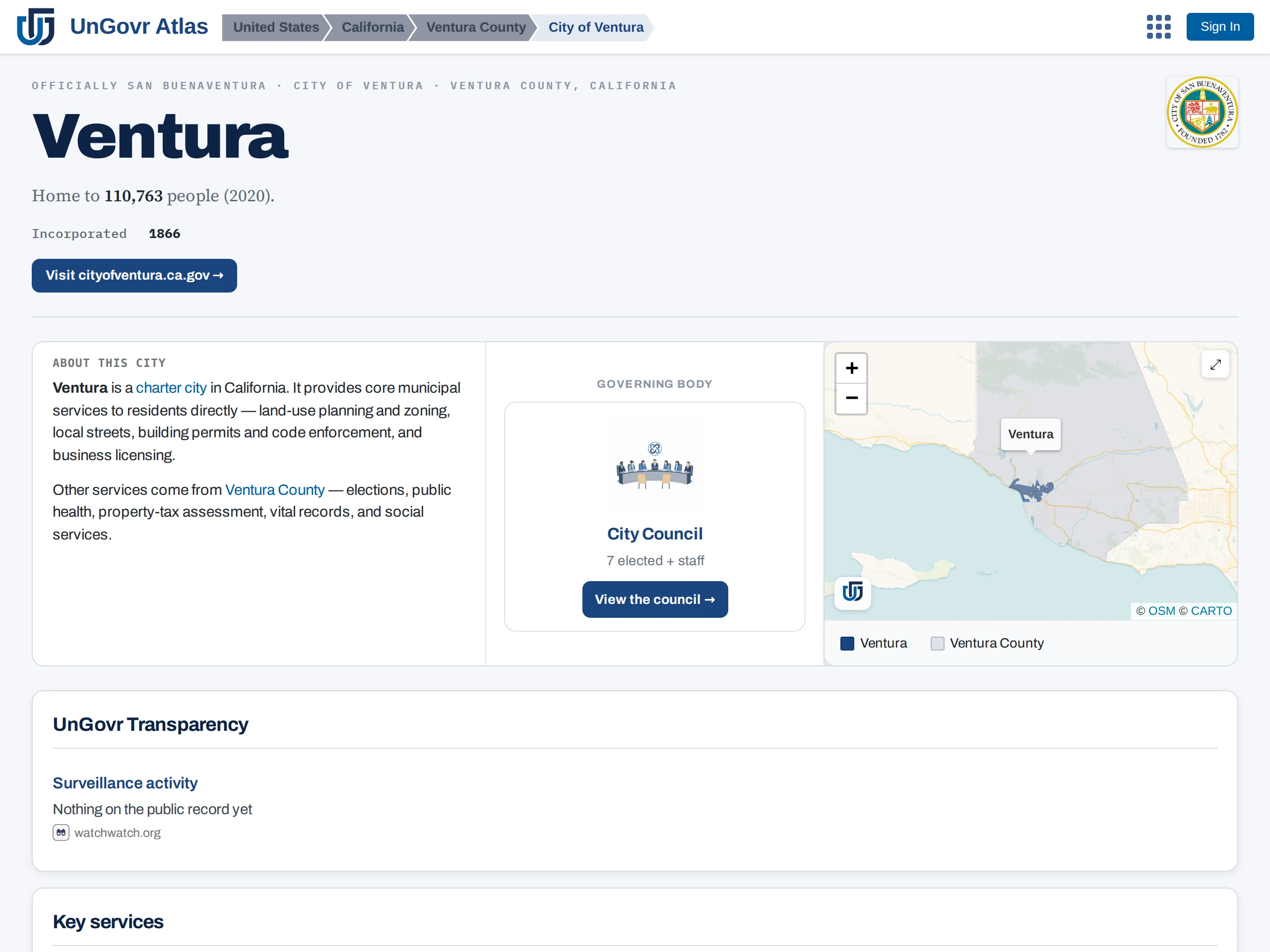
Every record carries the same spine: identity, place, structure, and the paths a person can act on. The record is what we maintain; the page is what it unlocks. Here is one of 330,000+.
The record · core schema
City of Ventura
Officially San Buenaventura- Type
- Municipality (charter city)
- Sits within
- County of Ventura → California → United States
- Boundary
- City limits polygon, on the map
- Services
- Service request routing for streets, parks, water, code enforcement
- Records law
- California Public Records Act
- Provenance
- Official register · government website crawl · verified records contact
Overlapping jurisdictions
One place answers to many governments.
Nesting is only half the story. Around the City of Ventura, districts lay their own boundaries over the same ground: schools, fire protection in the surrounding unincorporated areas, groundwater, sanitation, conservation. Every frame below is the same stretch of coast, and every shape contains the pin from the stack above; each one answers for a different legal responsibility. Add two regulated utilities on the record and that is how one point comes to eleven governments.
FIG. 2: ONE FRAME, SIX JURISDICTIONS, DRAWN FROM ATLAS BOUNDARIES. DASHED OUTLINE = CITY LIMITS; THE PIN IS THE SAME POINT AS FIG. 1.
Coverage
Where the map is deep today.
Depth varies by region and grows continuously. Headline numbers are canonical platform counts, refreshed nightly; the bar shows roughly what share of each region's entities have their boundary on the map.
| Region | What's mapped | Entities | With boundaries | |
|---|---|---|---|---|
| United States | All 50 states: counties, cities, special districts, school districts | 160,000+ | 34,000+ | |
| Europe | 48 countries; deepest in France, Italy, the United Kingdom, Germany, Spain | 100,000+ | 70,000+ | |
| Canada | Federal, provincial, municipal | 9,000+ | 5,000+ | |
| Ireland | National bodies, all 31 local authorities; UnGovr Request live | 380+ | 60+ | |
| Rest of world | National and subnational coverage across Asia, Africa, and the Americas | 55,000+ | 25,000+ |
Method
How we map government.
Mapping runs as a pipeline. The order matters: each step builds on the one before it.
Find
Official sources first: national registries, state rosters, boundary datasets, and each government's own website, read by our crawler and revisited as sites change.
Resolve
Every entity gets one canonical record: name, type, parent jurisdiction, domain, and contacts. Where boundary data exists for it, the record also carries the polygon of the territory it serves: 170,000+ entities have one so far.
Connect
Entities link to what they do: services and request paths, meetings, records laws, budgets, and oversight relationships.
Ask
Where the published record is silent, public records requests filed with the agencies themselves fill in what no dataset covers.